railroad.wikisort.org - Station
City Hall MRT station is an underground Mass Rapid Transit (MRT) interchange station on the North South Line (NSL) and East West Line (EWL). Situated in the Downtown Core district of Singapore, it is underneath Stamford Road near the road junctions with North Bridge Road and St Andrew's Road. The station is near landmarks such as the City Hall, Raffles City, the Padang, St Andrew's Cathedral and The Cenotaph.
NS25 EW13
City Hall 政府大厦 நகர மண்டபம் City Hall | ||||||||||||||||
|---|---|---|---|---|---|---|---|---|---|---|---|---|---|---|---|---|
| Mass Rapid Transit (MRT) interchange | ||||||||||||||||
 Exit B of City Hall MRT station with St Andrew's Cathedral in the background | ||||||||||||||||
| General information | ||||||||||||||||
| Location | 150 North Bridge Road Singapore 179100[1] | |||||||||||||||
| Coordinates | 1°17′35.66″N 103°51′7.99″E | |||||||||||||||
| Operated by | SMRT Trains (SMRT Corporation) | |||||||||||||||
| Line(s) | North South Line East West Line | |||||||||||||||
| Platforms | 4 (2 island platforms) | |||||||||||||||
| Tracks | 4 | |||||||||||||||
| Connections | CC3 Esplanade Bus, Taxi | |||||||||||||||
| Construction | ||||||||||||||||
| Structure type | Underground | |||||||||||||||
| Depth | 22 metres (72 ft)[2] | |||||||||||||||
| Platform levels | 2 | |||||||||||||||
| Parking | Yes (Raffles City) | |||||||||||||||
| Bicycle facilities | No | |||||||||||||||
| Disabled access | Yes | |||||||||||||||
| History | ||||||||||||||||
| Opened | 12 December 1987 | |||||||||||||||
| Electrified | Yes | |||||||||||||||
| Previous names | St. Andrew's[3][4] | |||||||||||||||
| Passengers | ||||||||||||||||
| October 2021 | 16,038 per day[5] | |||||||||||||||
| Services | ||||||||||||||||
| ||||||||||||||||
| Location | ||||||||||||||||
 City Hall City Hall station in Singapore | ||||||||||||||||
Initially named St Andrew's MRT station, the station was part of the early plans for the original MRT network since 1982. Construction of the tunnels between the City Hall and Raffles Place stations required the draining of the Singapore River. The station opened on 12 December 1987 with the MRT extension to Outram Park station. Cross-platform transfers between the NSL and EWL began on 28 October 1989, ahead of the opening of the MRT eastern line extension to Tanah Merah station on 4 November which split the MRT network into two lines. The station has three levels and is a designated Civil Defence shelter. The station features a mural by Simon Wong, depicting government buildings in the area.
History

The station, then named St Andrew's, was included in the early plans of the MRT network in May 1982.[6] It was renamed to City Hall in November that year for historical reasons and to better reflect the area served.[3][4] It was to be constructed as part of the Phase I MRT segment from the Novena to Outram Park stations;[7] this segment was targeted to be completed by December 1987.[8] This segment was given priority as it passes through areas that had a higher demand for public transport, such as the densely populated housing estates of Toa Payoh and Ang Mo Kio and the Central Area. The line aimed to relieve the traffic congestion on the Thomson–Sembawang road corridor.[9][10]
The contract for the construction of four 800-metre (870 yd) tunnels between the City Hall and Raffles Place stations was awarded to a joint venture between Kajima Corporation and Keppel Shipyard in October 1983 at S$35.65 million (US$45 million in 2020).[11][12] Another contract for the construction of the station was awarded to a joint venture between Nishimatsu and Lum Chang at S$77.65 million (US$97 million in 2020) in May 1984.[13][14] Construction of the station began on 7 September 1984 with a Christian ceremony near the St Andrews' Cathedral. The gathering prayed for the safety of the cathedral and the construction workers, the successful completion of the station, and blessings for future commuters.[15]
The construction of tunnels between the City Hall and Raffles Place stations required the draining of the Singapore River.[16] The contractor used the cut-and-cover construction method since the tunnels, which cross over one another, would pass through a shallow part of the river. The tunnel boring machine was launched from Empress Place, which is just by the river bank.[12] Due to the acidity of the Singapore River, a layer of concrete was added to the concrete frame around the tunnels, with a waterproofing additive for the base slab concrete.[17] The concrete frame was designed to prevent any corrosion and floatation of the tunnels.[12]
Due to requirements by the Ministry of Environment ensuring that the work site does not occupy more than 40% of the river width, the work would proceed in three stages.[17] The cofferdam in the first stage occupied about 20 metres (66 ft) of the river width from the riverbank at the Immigration Building site.[18] However, this restriction led to a limited work area. The piles installation was hindered by the boulders in the river, which had to be drilled through.[19] The works were close to the historical monuments of the Immigration Building and the Cavenagh Bridge. These two sites had to be closely monitored for any ground movement. Monitoring instruments such as inclinometers and levelling pins were used to detect any structural movement.[17]
There were concerns that the Cavenagh Bridge would not be able to absorb any significant strains with the settlement of the bridge's anchor blocks. Saddles, joined by prestressing cables, were placed on either side of the bridge to unload and loosen the links and bridge wedges. However, these wedges could not be loosened. Instead, other temporary supports were placed to relieve any stress on the bridge. After finding some cracks on the entrance façade of the Immigration Building, the contractors underpinned the columns at the entrance.[19]
The first stage of the construction was completed in May 1985, with a delay of seven months. To speed up the construction, the Environment Ministry agreed to lift restrictions on the work area.[20] The rest of the construction was completed in one stage, taking up the remaining 70 metres (230 ft) of the river width.[18] The subsequent stage also used fewer piles with the mixed use of cut slopes.[17] Installation of the 2nd stage cofferdam began in May and works were completed within 12 months.[21]
During the station's construction, on 26 May 1985, the collapse of a portion of the supporting wall led to a landslip at the construction site.[22] Those in the nearby St Andrew's Cathedral were evacuated as a safety precaution.[23] The church was eventually declared safe for use and operations resumed on 2 June with the collapsed area backfilled. The engineers for the construction advised the church against using the half of the Cathedral near the site.[22] On 10 December, a Japanese foreman miner died, having fallen through a shaft.[24][25] It was noted that the foreman did not have his safety belt fastened. Investigations revealed that it was entirely an accident, with all other safety measures observed.[26]
Train services commenced on 12 December 1987 when the line extension to Outram Park station was completed.[27][28] The station was part of a route that ran continuously from Yishun station in the north to Lakeside station in the west. From 28 October 1989, it began to serve the NSL when MRT operations were split.[29][lower-alpha 1] In September 2000, the Land Transport Authority (LTA) installed lifts to allow barrier-free access to the station.[31]
The LTA announced plans in May 2014 to construct a new underpass between the station and the redeveloped Capitol Singapore. Construction of the underground link and the new entrance started in the fourth quarter of 2014, and was completed in the first quarter of 2015.[32][33] Another linkway to Funan Centre, first announced in November 2017,[34] was completed in December 2021.[35]
Station details
Track layout | ||||||||||||||||||||||||||||||||||||||||||||||||||||||||||||||||||||||
|---|---|---|---|---|---|---|---|---|---|---|---|---|---|---|---|---|---|---|---|---|---|---|---|---|---|---|---|---|---|---|---|---|---|---|---|---|---|---|---|---|---|---|---|---|---|---|---|---|---|---|---|---|---|---|---|---|---|---|---|---|---|---|---|---|---|---|---|---|---|---|
Upper level (B2) | ||||||||||||||||||||||||||||||||||||||||||||||||||||||||||||||||||||||
| ||||||||||||||||||||||||||||||||||||||||||||||||||||||||||||||||||||||
Lower level (B3) | ||||||||||||||||||||||||||||||||||||||||||||||||||||||||||||||||||||||
| ||||||||||||||||||||||||||||||||||||||||||||||||||||||||||||||||||||||

City Hall station is one of two stations which are paired cross-platform interchanges between the NSL and EWL. From the north, the station is after Bugis on the EWL and after Dhoby Ghaut station on the NSL. Both lines continue and interchange at Raffles Place station. The official station code is NS25/EW13.[36] Before the MRT eastern extension to Tanah Merah station and the Marina Bay southern extension on 4 November 1989, through services operated from the Yishun to Lakeside stations. A few days before the opening, on 28 October, transfer drills were launched for commuters to familiarise themselves with transferring between the two services: with passengers from Yishun having to alight at either Raffles Place or City Hall to continue their journey to Lakeside or vice versa.[29] In addition to advertisement campaigns and guides about the transfers, Mass Rapid Transit Corporation (MRTC) staff were deployed at the platforms to help commuters.[37]
With a depth of 22 metres (72 ft),[2] the station has three levels, two of which contain island platforms.[15][38] The station has one of the MRT system's longest escalators at 11.6 metres (38 ft).[39] City Hall is one of the first nine underground MRT stations designated as a Civil Defence (CD) shelter. As a CD shelter, the station has to be structurally reinforced against bomb attacks with layers of earth-backed, air-backed and airtight walls and slabs.[40][41] A mural by Simon Wong is displayed at this station as part of the MRTC's S$2 million (US$2 million in 2020) commission of artworks at six MRT stations along the NSL.[42] The mural, depicting government buildings in the area,[43] reflects the station's themes of governance, justice and administration.[44]
The station has four entrances.[45] Located in the Singapore Civic District, the station is underneath Stamford Road near the junction with North Bridge Road.[1][45] Surrounding the station are cultural landmarks such as City Hall, Peranakan Museum, The Padang, St Andrew's Cathedral, National Gallery Singapore, Old Supreme Court Building, Supreme Court of Singapore, Parliament House and The Cenotaph. Nearby commercial and retail developments include Marina Square, One Raffles Link, Raffles City and Suntec City.[46] The station is within walking distance of the Esplanade and Bras Basah stations on the Circle line.[45][47]
Notes and references
Footnotes
- The MRT system was split into East West line (running from Tanah Merah station to Lakeside) and the NSL (running from Yishun station to Marina Bay).[30]
References
- "City Hall MRT station (EW13 / NS25)". OneMap. Singapore Land Authority. Retrieved 7 March 2022.
- "Work on last Phase 1 station begins with ground-breaking". Singapore Monitor. 7 September 1984. p. 5.
- "New names for eight stations". Singapore Monitor. 30 November 1982. p. 22.
- "Station names will reflect their localities". The Straits Times. Singapore Press Holdings. 30 November 1982. p. 7 – via NewspaperSG.
- "Land Transport DataMall". mytransport.sg. Archived from the original on 21 August 2020. Retrieved 11 December 2020.
- "Proposed MRT stations". The Straits Times. Singapore Press Holdings. 23 May 1982. p. 1. Retrieved 12 December 2020 – via NewspaperSG.
{{cite news}}: CS1 maint: url-status (link) - "Project to go on line in three stages". The Straits Times. Singapore Press Holdings. 8 July 1986. p. 8. Retrieved 19 December 2020 – via NewspaperSG.
- "MRT system to be implemented in eight stages". The Straits Times. Singapore Press Holdings. 9 April 1987. p. 30. Retrieved 19 December 2020 – via NewspaperSG.
- Annual report. Singapore: Provisional Mass Rapid Transit Authority. 1983. p. 5.
- Dhaliwal, Rav (29 August 1982). "North-south line off first". The Straits Times. Singapore Press Holdings. p. 1. Retrieved 19 December 2020 – via NewspaperSG.
{{cite news}}: CS1 maint: url-status (link) - "Local builders in joint ventures win MRT jobs". The Straits Times. Singapore Press Holdings. 9 October 1983. p. 14. Retrieved 6 March 2022 – via NewspaperSG.
- MRTC 1987, p. 251.
- "Japanese win MRT awards". Business Times. Singapore Press Holdings. 5 May 1984. Retrieved 23 August 2020 – via NewspaperSG.
- "Lum Chang – Civil & Infrastructure". lumchang.com.sg. Archived from the original on 13 April 2020. Retrieved 13 April 2020.
- Dhaliwal, Rav (8 September 1984). "A prayer for the City Hall MRT station". The Straits Times. Singapore Press Holdings. p. 12 – via NewspaperSG.
- "Singapore River to be 'drained' for MRT job". Business Times. Singapore Press Holdings. 13 March 1984. p. 1. Retrieved 24 August 2020.
{{cite news}}: CS1 maint: url-status (link) - MRTC 1987, p. 254.
- "MRT 'river crossing' easier than expected". The Straits Times. Singapore Press Holdings. 26 April 1985. p. 11 – via NewspaperSG.
- MRTC 1987, p. 258.
- MRTC 1987, p. 259.
- MRTC 1987, p. 260.
- "Cathedral is safe for use". The Straits Times. Singapore Press Holdings. 1 June 1985. Retrieved 23 August 2020 – via NewspaperSG.
{{cite news}}: CS1 maint: url-status (link) - Dhaliwal, Rav (27 May 1985). "Surprise cathedral clearance causes no alarm". The Straits Times. Singapore Press Holdings. p. 8. Retrieved 23 August 2020 – via NewspaperSG.
{{cite news}}: CS1 maint: url-status (link) - "Foreman died at City Hall MRT Station". Business Times. Singapore Press Holdings. 10 December 1985. Retrieved 5 October 2017 – via NewspaperSG.
{{cite web}}: CS1 maint: url-status (link) - "Foreman dies after fall at MRT worksite". The Straits Times. Singapore Press Holdings. 10 December 1985. Retrieved 23 August 2020 – via NewspaperSG.
- "Japanese tunnel supervisor's death fall: It's misadventure". The Straits Times. Singapore Press Holdings. 24 September 1987. Retrieved 23 August 2020 – via NewspaperSG.
- "20 stations by next year". The Straits Times. Singapore Press Holdings. 6 November 1987. Retrieved 10 September 2020 – via NewspaperSG.
{{cite news}}: CS1 maint: url-status (link) - Rav, Dhaliwal (12 December 1987). "Shopping for Xmas the MRT way..." The Straits Times. Singapore Press Holdings. Retrieved 19 September 2017 – via NewspaperSG.
{{cite news}}: CS1 maint: url-status (link) - "MRT transfers will begin this Saturday". The Straits Times. Singapore Press Holdings. 24 October 1989. p. 3. Retrieved 13 September 2021 – via NewspaperSG.
- "Easy MRT train transfers – with colour code guide". The Straits Times. Singapore Press Holdings. 20 September 1989. Retrieved 21 September 2021 – via NewspaperSG.
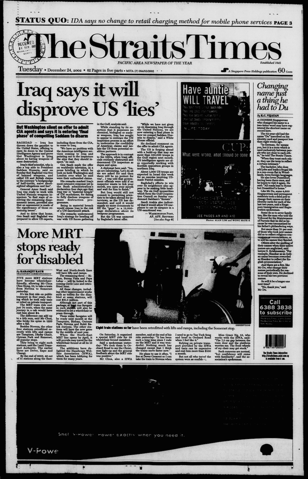
- "More MRT stops ready for disabled". The Straits Times. Singapore Press Holdings. 24 December 2002. p. 1. Archived from the original on 21 February 2022. Retrieved 4 March 2022.
- "Underpass to link City Hall MRT and Capitol Singapore". Today. 27 May 2014. Archived from the original on 7 March 2022. Retrieved 13 April 2020.
- "News Room – News Releases – Better Pedestrian Connectivity from City Hall MRT Station". LTA. 27 May 2014. Archived from the original on 23 August 2020. Retrieved 23 August 2020.
- Tan, Tam Mei (13 November 2017). "Underground walkway will link the new Funan mall to City Hall MRT". The Straits Times. Archived from the original on 12 April 2019. Retrieved 7 March 2022.
- Elangovan, Navene (20 December 2021). "100m underground pedestrian link between City Hall MRT Station and Funan mall opens". TODAY. Archived from the original on 21 December 2021. Retrieved 5 March 2022.
- "MRT System Map" (PDF). lta.gov.sg. Land Transport Authority. Archived (PDF) from the original on 21 August 2020. Retrieved 23 August 2020.
- "MRT transfers drill off to smooth start". The Straits Times. Singapore Press Holdings. 29 October 1989. p. 21 – via NewspaperSG.
- "Three-level station for City Hall Station". Singapore Monitor. 30 November 1982. p. 43. Archived from the original on 7 March 2022. Retrieved 24 August 2020.
- "MRT showpiece station opens for public viewing". The Straits Times. Singapore Press Holdings. 28 November 1987. p. 19.
- MRTC 1984, p. B10.
- MRTC 1987, p. 125.
- "$2m worth of art for six MRT stations". The Straits Times. Singapore Press Holdings. 5 December 1987 – via NewspaperSG.
- Choo, Jonathan (12 December 1987). "Reflections of our lifestyle". The Straits Times. Singapore Press Holdings. p. 4. Retrieved 10 September 2020 – via NewspaperSG.
{{cite news}}: CS1 maint: url-status (link) - "Local works of art to grace MRT stations". The Straits Times. Singapore Press Holdings. 26 April 1987. p. 14. Retrieved 7 March 2022 – via NewspaperSG.
- "City Hall – Map". SMRT Journeys. SMRT Corporation. Archived from the original on 1 November 2021. Retrieved 5 March 2022.
- "City Hall – Exits". SMRT Journeys. SMRT Corporation. Archived from the original on 1 November 2021. Retrieved 5 March 2022.
- "System Map (with walking time)". lta.gov.sg. Land Transport Authority. 7 June 2019. Archived from the original on 7 June 2019. Retrieved 5 March 2022.
Bibliography
- Information portfolio. Singapore: Mass Rapid Transit Corporation. 1984.
- Mass Rapid Transit System: Proceedings of the Singapore Mass Rapid Transit Conference. Singapore: Mass Rapid Transit Corporation. 1987. ISBN 9971-84-636-5. OCLC 82363485.
External links
 Media related to City Hall MRT Station at Wikimedia Commons
- Official website
- Changi Airport to City Hall MRT station route
Другой контент может иметь иную лицензию. Перед использованием материалов сайта WikiSort.org внимательно изучите правила лицензирования конкретных элементов наполнения сайта.
WikiSort.org - проект по пересортировке и дополнению контента Википедии