railroad.wikisort.org - Station
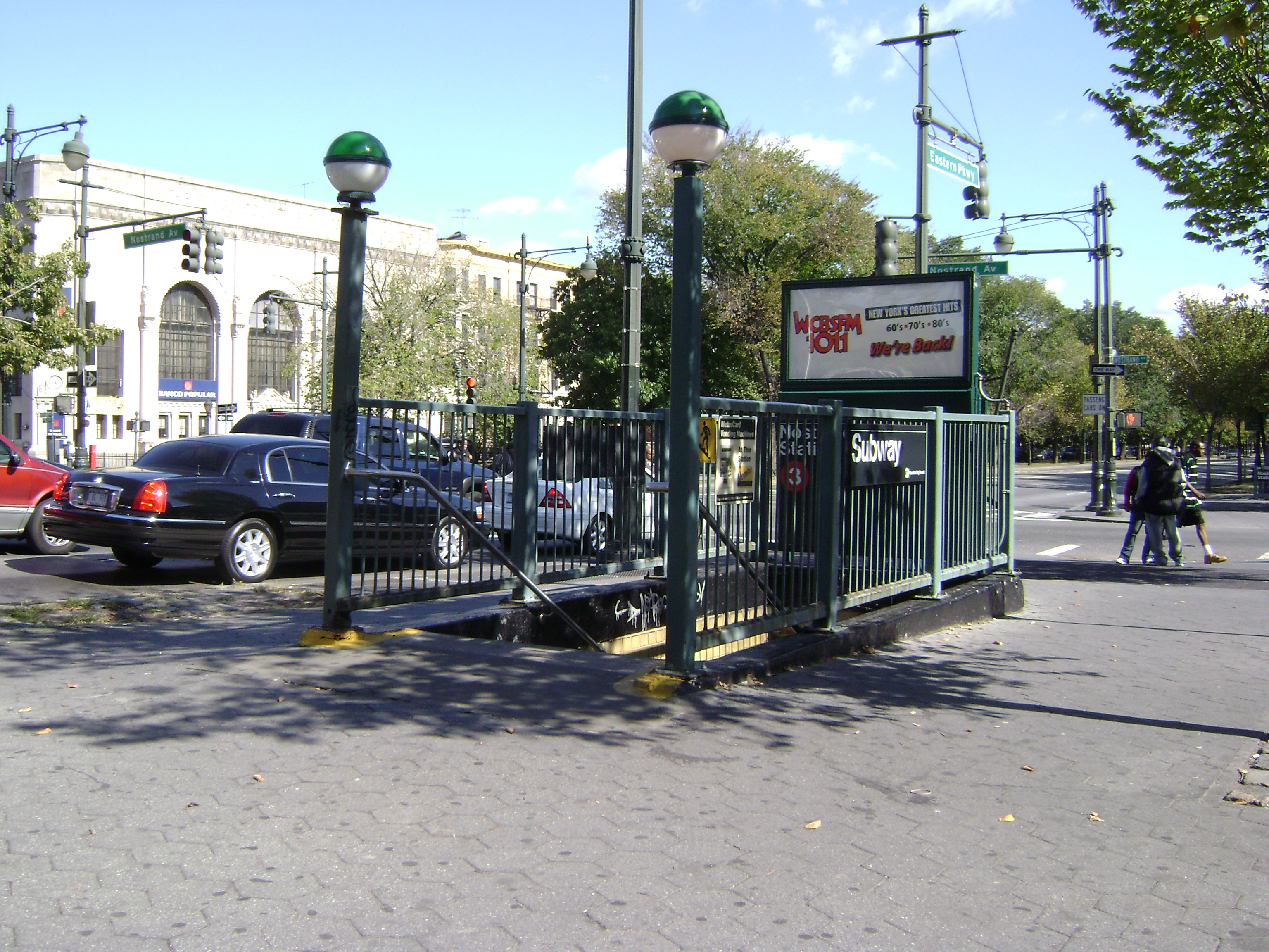
The Nostrand Avenue station is a local station on the IRT Eastern Parkway Line of the New York City Subway. Located at the intersection of Nostrand Avenue and Eastern Parkway in Crown Heights, Brooklyn, it is served by the 3 train at all times except late nights, when the 4 train takes over service. There is also limited rush hour 2 and 5 service here.
Nostrand Avenue | |||||||||||||||||||||||||||||||||||||||||||||||||||||||||||||||||||||||||||||||||||||||||||||||||||||||||||||||||||||||||||||||||||||||||||||
|---|---|---|---|---|---|---|---|---|---|---|---|---|---|---|---|---|---|---|---|---|---|---|---|---|---|---|---|---|---|---|---|---|---|---|---|---|---|---|---|---|---|---|---|---|---|---|---|---|---|---|---|---|---|---|---|---|---|---|---|---|---|---|---|---|---|---|---|---|---|---|---|---|---|---|---|---|---|---|---|---|---|---|---|---|---|---|---|---|---|---|---|---|---|---|---|---|---|---|---|---|---|---|---|---|---|---|---|---|---|---|---|---|---|---|---|---|---|---|---|---|---|---|---|---|---|---|---|---|---|---|---|---|---|---|---|---|---|---|---|---|---|
 Northbound platform | |||||||||||||||||||||||||||||||||||||||||||||||||||||||||||||||||||||||||||||||||||||||||||||||||||||||||||||||||||||||||||||||||||||||||||||
| Station statistics | |||||||||||||||||||||||||||||||||||||||||||||||||||||||||||||||||||||||||||||||||||||||||||||||||||||||||||||||||||||||||||||||||||||||||||||
| Address | Nostrand Avenue & Eastern Parkway Brooklyn, NY 11216[1] | ||||||||||||||||||||||||||||||||||||||||||||||||||||||||||||||||||||||||||||||||||||||||||||||||||||||||||||||||||||||||||||||||||||||||||||
| Borough | Brooklyn | ||||||||||||||||||||||||||||||||||||||||||||||||||||||||||||||||||||||||||||||||||||||||||||||||||||||||||||||||||||||||||||||||||||||||||||
| Locale | Crown Heights | ||||||||||||||||||||||||||||||||||||||||||||||||||||||||||||||||||||||||||||||||||||||||||||||||||||||||||||||||||||||||||||||||||||||||||||
| Coordinates | 40.6698°N 73.95052°W | ||||||||||||||||||||||||||||||||||||||||||||||||||||||||||||||||||||||||||||||||||||||||||||||||||||||||||||||||||||||||||||||||||||||||||||
| Division | A (IRT)[2] | ||||||||||||||||||||||||||||||||||||||||||||||||||||||||||||||||||||||||||||||||||||||||||||||||||||||||||||||||||||||||||||||||||||||||||||
| Line | IRT Eastern Parkway Line | ||||||||||||||||||||||||||||||||||||||||||||||||||||||||||||||||||||||||||||||||||||||||||||||||||||||||||||||||||||||||||||||||||||||||||||
| Services | 2 3 4 5 | ||||||||||||||||||||||||||||||||||||||||||||||||||||||||||||||||||||||||||||||||||||||||||||||||||||||||||||||||||||||||||||||||||||||||||||
| Transit | |||||||||||||||||||||||||||||||||||||||||||||||||||||||||||||||||||||||||||||||||||||||||||||||||||||||||||||||||||||||||||||||||||||||||||||
| Structure | Underground | ||||||||||||||||||||||||||||||||||||||||||||||||||||||||||||||||||||||||||||||||||||||||||||||||||||||||||||||||||||||||||||||||||||||||||||
| Levels | 2 | ||||||||||||||||||||||||||||||||||||||||||||||||||||||||||||||||||||||||||||||||||||||||||||||||||||||||||||||||||||||||||||||||||||||||||||
| Platforms | 2 side platforms (1 on each level) | ||||||||||||||||||||||||||||||||||||||||||||||||||||||||||||||||||||||||||||||||||||||||||||||||||||||||||||||||||||||||||||||||||||||||||||
| Tracks | 4 (2 on each level) | ||||||||||||||||||||||||||||||||||||||||||||||||||||||||||||||||||||||||||||||||||||||||||||||||||||||||||||||||||||||||||||||||||||||||||||
| Other information | |||||||||||||||||||||||||||||||||||||||||||||||||||||||||||||||||||||||||||||||||||||||||||||||||||||||||||||||||||||||||||||||||||||||||||||
| Opened | August 23, 1920 | ||||||||||||||||||||||||||||||||||||||||||||||||||||||||||||||||||||||||||||||||||||||||||||||||||||||||||||||||||||||||||||||||||||||||||||
| Opposite- direction transfer | Yes | ||||||||||||||||||||||||||||||||||||||||||||||||||||||||||||||||||||||||||||||||||||||||||||||||||||||||||||||||||||||||||||||||||||||||||||
| Traffic | |||||||||||||||||||||||||||||||||||||||||||||||||||||||||||||||||||||||||||||||||||||||||||||||||||||||||||||||||||||||||||||||||||||||||||||
| 2019 | 1,370,372[4] | ||||||||||||||||||||||||||||||||||||||||||||||||||||||||||||||||||||||||||||||||||||||||||||||||||||||||||||||||||||||||||||||||||||||||||||
| Rank | 313 out of 424[4] | ||||||||||||||||||||||||||||||||||||||||||||||||||||||||||||||||||||||||||||||||||||||||||||||||||||||||||||||||||||||||||||||||||||||||||||
| |||||||||||||||||||||||||||||||||||||||||||||||||||||||||||||||||||||||||||||||||||||||||||||||||||||||||||||||||||||||||||||||||||||||||||||
| |||||||||||||||||||||||||||||||||||||||||||||||||||||||||||||||||||||||||||||||||||||||||||||||||||||||||||||||||||||||||||||||||||||||||||||
| |||||||||||||||||||||||||||||||||||||||||||||||||||||||||||||||||||||||||||||||||||||||||||||||||||||||||||||||||||||||||||||||||||||||||||||
| |||||||||||||||||||||||||||||||||||||||||||||||||||||||||||||||||||||||||||||||||||||||||||||||||||||||||||||||||||||||||||||||||||||||||||||
| |||||||||||||||||||||||||||||||||||||||||||||||||||||||||||||||||||||||||||||||||||||||||||||||||||||||||||||||||||||||||||||||||||||||||||||


The station opened on August 23, 1920, as part of an extension of the IRT Eastern Parkway Line by the Interborough Rapid Transit Company. The station's platforms were extended in the 1964—1965 fiscal year so they could accommodate ten-car trains.
History

Background
Nostrand Avenue station was constructed as part of the Eastern Parkway Line. The line's section to Atlantic Avenue was part of Contract 2 of the Interborough Rapid Transit Company (IRT)'s plan to construct an extension of the original subway, Contract 1. Contract 2 extended the original line from City Hall in Manhattan to Atlantic Avenue in Brooklyn. The Board of Rapid Transit Commissioners approved the route on September 27, 1900,[5] and the contract was signed on September 11, 1902. Construction commenced on Contract 2 on March 4, 1903.[6] The first section opened on January 9, 1908, extending the subway from Bowling Green to Borough Hall.[7][8][9] On April 28, 1908, the IRT formally applied with the New York Public Service Commission for permission to open the final section of the Contract 2 line from Borough Hall to Atlantic Avenue near the Flatbush Avenue LIRR station. The application was approved, and the IRT extension opened on May 1, 1908.[10]: 194 [6]
On March 19, 1913, New York City, the Brooklyn Rapid Transit Company, and the IRT reached an agreement, known as the Dual Contracts, to drastically expand subway service across New York City. As part of Contract 3 of the agreement, between New York City and the IRT, the original subway opened by the IRT in 1904 to City Hall,[11] and extended to Atlantic Avenue in 1908,[12] was to be extended eastward into Brooklyn.[13] The line was to be extended along Flatbush Avenue and Eastern Parkway to Buffalo Street as a four-track subway line, and then along East 98th Street and Livonia Avenue to New Lots Avenue as an elevated two-track line, with provisions for the addition of a third track. In addition, a two-track branch line along Nostrand Avenue branching off east of the Franklin Avenue station was to be constructed.[14] The underground portion of the line became known as the Eastern Parkway Line, or Route 12, while the elevated portion became known as the New Lots Line.[15]
Construction and opening
The IRT Eastern Parkway Line was built as part of Route 12 from 1915 to 1918.[16] On August 23, 1920, the Eastern Parkway Line was extended from Atlantic Avenue to Crown Heights–Utica Avenue, with the Nostrand Avenue station opening at this time. The new trains would be served by trains from Seventh Avenue.[17]
Later years
During the 1964–1965 fiscal year, the platforms at Kingston Avenue, along with those at four other stations on the Eastern Parkway Line, were lengthened to 525 feet (160 m) to accommodate a ten-car train of 51-foot (16 m) IRT cars.[18]
Station layout
| G | Street level | Exit/entrance |
| B1 | Southbound express | |
| Southbound local | | |
| Side platform | ||
| Mezzanine | Fare control, station agent, MetroCard machines | |
| B2 | Northbound express | ← ← |
| Northbound local | ← ← ← ← | |
| Side platform | ||
This underground station has two levels. The upper level serves New Lots Avenue-bound trains while the lower level serves Manhattan-bound trains. From north to south, each level has an express track, a local track, and one side platform.[19] The 3 train stops here at all times except late nights, when the 4 train takes over service. There is also limited rush hour 2 and 5 train service here. During all times except late nights, 4 trains run on the express track to the north of the local track on each level to bypass the station.[20][21][22][23]
Both platforms have their original Dual Contracts-era IRT trim line and name tablets. The trim line has a tan-yellow center, brown border, and a spec of blue in-between. "N" tablets on a blue background and brown border run along the trim line at regular intervals. The name tablets read "NOSTRAND AVE." in Times New Roman font in gold lettering on a blue and brown background, a gold center, and brown border.
The platform extensions at either end have signs reading "NOSTRAND AVE" in white sans serif lettering on a brown border. The center of the platforms has green I-beam columns at regular intervals with alternating ones having the standard black station name plate in white lettering.
West of this station (railroad north), the perpendicular IRT Nostrand Avenue Line merges with the IRT Eastern Parkway Line at the Rogers Avenue Junction. President Street–Medgar Evers College on that line is two blocks to the south.[24]
Exits
The upper level has one fare control at the center with two staircases going down to the lower level. It has a turnstile bank, token booth, and two staircases going up to the south side mall of Eastern Parkway (between the main and service roads) and Nostrand Avenue. One staircase goes to the southeast corner while the other goes to the southwest corner.[24]
References
- "Borough of Brooklyn, New York City". Government of New York City. Retrieved April 16, 2020.
- "Glossary". Second Avenue Subway Supplemental Draft Environmental Impact Statement (SDEIS) (PDF). Vol. 1. Metropolitan Transportation Authority. March 4, 2003. pp. 1–2. Archived from the original (PDF) on February 26, 2021. Retrieved January 1, 2021.
- "Brooklyn Bus Map" (PDF). Metropolitan Transportation Authority. October 2020. Retrieved December 1, 2020.
- "Facts and Figures: Annual Subway Ridership 2014–2019". Metropolitan Transportation Authority. 2020. Retrieved May 26, 2020.
- Report of the Public Service Commission for the First District of the State of New York for the Year Ending December 31, 1909 Vol. 1. New York State Public Service Commission. 1910. p. 195.
- "Brooklyn Joyful Over New Subway". The New York Times. May 2, 1908. p. 1.
- "Subway to Brooklyn Opened for Traffic; First Regular Passenger Train Went Under the East River Early This Morning. Not a Hitch in the Service. Gov. Hughes and Brooklyn Officials to Join in a Formal Celebration of Event To-day". the New York Times. January 9, 1908. Retrieved September 1, 2016.
- "Brooklyn Joyful Over Its Tunnel". The New York Times. January 10, 1908. Retrieved March 6, 2010.
- Gasparini, D. A. (February 2006). "Battery-Joralemon Street Tunnel". Journal of Performance of Constructed Facilities. American Society of Civil Engineers. 20 (1): 92–107. doi:10.1061/(ASCE)0887-3828(2006)20:1(92).[permanent dead link]
- Report of the Public Service Commission For The First District of the State of New York For The Year Ending December 31, 1908. New York State Public Service Commission. 1908.
- "Exercises In City Hall.; Mayor Declares Subway Open -- Ovations for Parsons and McDonald". The New York Times. October 28, 1904. Retrieved December 16, 2018.
- "Brooklyn Joyful Over New Subway — Celebrates Opening of Extension with Big Parade and a Flow of Oratory — An Ode to August Belmont — Anonymous Poet Calls Him "the Brownie of the Caisson and Spade" — He Talks on Subways". The New York Times. May 2, 1908. p. 1. Retrieved November 6, 2016.
- "618 Miles of Track In The Dual System; City Will Have Invested $226,000,000 When Rapid Transit Project Is Completed". The New York Times. August 3, 1913. Retrieved April 25, 2018.
- Comptroller's Monthly Report For March 1916 And From January 1, 1916 To March 31, 1916. New York City Department of Finance. 1916. p. 121.
- "Differ Over Assessment Plans in Transit Projects: Eastern Parkway Subway and Livonia Avenue Extension the Cause of Bitter Dissension Among Property Owners Uptown" (PDF). The Daily Standard Union. March 13, 1910. Retrieved August 14, 2016 – via Fulton History.
- "More Interborough Service for Brooklyn 2 New Lines". pudl.princeton.edu. Interborough Rapid Transit Company. August 23, 1920. Retrieved September 19, 2016.
- "Brooklyn Tube Extensions Open: I.R.T. Begins Service on Eastern Parkway and Nostrand Avenue Lines" (PDF). The New York Times. August 23, 1920. Retrieved December 20, 2015.
- Annual Report 1964–1965. New York City Transit Authority. 1965.
- Dougherty, Peter (2006) [2002]. Tracks of the New York City Subway 2006 (3rd ed.). Dougherty. OCLC 49777633 – via Google Books.
- "2 Subway Timetable, Effective June 26, 2022". Metropolitan Transportation Authority. Retrieved August 1, 2022.
- "3 Subway Timetable, Effective June 26, 2022". Metropolitan Transportation Authority. Retrieved August 1, 2022.
- "4 Subway Timetable, Effective June 26, 2022". Metropolitan Transportation Authority. Retrieved August 1, 2022.
- "5 Subway Timetable, Effective June 26, 2022". Metropolitan Transportation Authority. Retrieved August 1, 2022.
- "Nostrand Avenue Neighborhood Map". mta.info. Metropolitan Transportation Authority. April 2018. Retrieved May 20, 2022.
External links
- nycsubway.org – Brooklyn IRT: Nostrand Avenue
- Brooklyn IRT: Map 2, Brooklyn IRT Dual Contracts (includes current and former track configurations, and provisions for future connections)
- Station Reporter — 3 Train
Stations of the New York City Subway, by line (physical trackage) | |
|---|---|
| Eastern Pkwy. Line |
|
| |
На других языках
- [en] Nostrand Avenue station (IRT Eastern Parkway Line)
[ru] Ностранд-авеню (линия Истерн-Паркуэй, Ай-ар-ти)
«Ностранд-авеню» (англ. Nostrand Avenue) — станция Нью-Йоркского метрополитена, расположенная на линии Истерн-Паркуэй, Ай-ар-ти. Станция находится в Бруклине, в округе Краун Хайтс, на пересечении Ностранд-авеню и Истерн-паркуэя. На станции останавливаются маршруты: 2 (часть рейсов в часы пик в пиковом направлении), 3 (круглосуточно, кроме ночи) и 4 (ночью). Станцию проходят без остановки маршруты 4 (круглосуточно, кроме ночи) и 5 (часть рейсов в часы пик в пиковом направлении).Другой контент может иметь иную лицензию. Перед использованием материалов сайта WikiSort.org внимательно изучите правила лицензирования конкретных элементов наполнения сайта.
WikiSort.org - проект по пересортировке и дополнению контента Википедии