railroad.wikisort.org - Station
Banstead railway station serves the village of Banstead in the borough of Reigate and Banstead in Surrey. Its wider definition of Banstead Village and Nork wards is relevant here as both are equally well served by it as it lies narrowly in the latter. The station and all trains are operated by Southern and it is on the Epsom Downs line, part of the Sutton & Mole Valley Line services. It is between Belmont and Epsom Downs, 17 miles 40 chains (17.50 miles, 28.16 km) down the line from London Bridge, measured via West Croydon.[2]
| Banstead | |
|---|---|
 | |
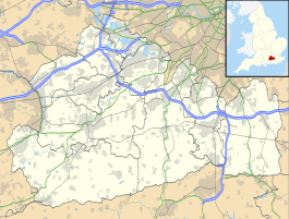 Banstead Location of Banstead in Surrey | |
| Location | Banstead |
| Local authority | Borough of Reigate and Banstead |
| Managed by | Southern |
| Station code | BAD |
| DfT category | F1 |
| Number of platforms | 1 |
| Fare zone | 6 |
| National Rail annual entry and exit | |
| 2016–17 | |
| 2017–18 | |
| 2018–19 | |
| 2019–20 | |
| 2020–21 | |
| Railway companies | |
| Original company | London, Brighton and South Coast Railway |
| Pre-grouping | London, Brighton and South Coast Railway |
| Post-grouping | Southern Railway |
| Key dates | |
| 22 May 1865 | Opened as Banstead |
| 1 June 1898 | Renamed Banstead and Burgh Heath |
| August 1928 | Renamed Banstead |
| Other information | |
| External links | |
| WGS84 | 51.329194°N 0.213194°W |
Housing and gardens in Banstead in this area border Greater London 500m away to the north. Accordingly, since January 2006, the station has been included in Travelcard Zone 6. The station lies some distance to the north-west of the High Street on the edge of Banstead Downs.
Station buildings

The station was opened by the London, Brighton and South Coast Railway on 22 May 1865 as part of the Epsom Downs branch line. The branch was originally laid as double track to accommodate Epsom Downs horse race traffic and was electrified on 17 June 1928. In the 1940s, the station's name was painted in large letters on the roof as a navigation tool for pilots coming into Croydon Airport. Due to the destruction by fire of the Epsom Downs signal box in November 1981, the branch was singled for most of its length in October 1982 and trains stopping at Banstead now use only the Down platform where there is a shelter. The Up track and platform have been removed.
Services
All services at Banstead are operated by Southern using Class 377 EMUs.
The typical off-peak service in trains per hour is:[3]
- 2 tph to London Victoria via Norbury
- 2 tph to Epsom Downs
Prior to May 2018, the station was served by an hourly service on weekdays and Saturdays only, with no Sunday service. In May 2018, a half-hourly service was introduced on all days of the week.
There is an electronic display showing arrivals and departures. A ticket machine was installed in October 2011 replacing a Permit to Travel machine and there are also 2 Oystercard readers.
| Preceding station | Following station | |||
|---|---|---|---|---|
Belmont | Southern Epsom Downs Branch | |||
References
- "Estimates of station usage". Rail statistics. Office of Rail Regulation. Please note: Some methodology may vary year on year.
- Yonge, John (November 2008) [1994]. Jacobs, Gerald (ed.). Railway Track Diagrams 5: Southern & TfL (3rd ed.). Bradford on Avon: Trackmaps. map 22. ISBN 978-0-9549866-4-3.
- Table 172 National Rail timetable, May 2022
External links
- Train times and station information for Banstead railway station from National Rail
- Map includes Epsom Down Line
- The Epsom Downs branch website
- Station name on the roof
Transport in London | |||||||||||||||||
|---|---|---|---|---|---|---|---|---|---|---|---|---|---|---|---|---|---|
| Companies and organisations |
| ||||||||||||||||
| Airports |
| ||||||||||||||||
| Major stations |
| ||||||||||||||||
| Roads |
| ||||||||||||||||
| Ticketing |
| ||||||||||||||||
| Other |
| ||||||||||||||||
| Former BR sectors |
| ||||||||||||||||
| |||||||||||||||||
| Towns, villages, neighbourhoods and hamlets |
|  | ||||||||||||||
|---|---|---|---|---|---|---|---|---|---|---|---|---|---|---|---|---|
| Most notable parks |
| |||||||||||||||
| Places of worship |
| |||||||||||||||
| Education |
| |||||||||||||||
| Transport |
| |||||||||||||||
| Buildings and structures |
| |||||||||||||||
| Sport | ||||||||||||||||
| Politics and Administration |
| |||||||||||||||
Places listed are articles notable as settlements, arranged by post town The two principal towns are emboldened The M23 motorway follows approximately a boundary and is chiefly included for its regional importance. | ||||||||||||||||
Другой контент может иметь иную лицензию. Перед использованием материалов сайта WikiSort.org внимательно изучите правила лицензирования конкретных элементов наполнения сайта.
WikiSort.org - проект по пересортировке и дополнению контента Википедии