railroad.wikisort.org - Station
Watertown Square is the main square of Watertown, Massachusetts, located at the confluence of North Beacon Street and Main Street (US-20), Mt. Auburn Street (MA-16), Pleasant Street, Arsenal Street, and Charles River Road. The Armenian Library and Museum of America is located in the square; Watertown Dam is 1,000 feet (300 m) to the west.
Watertown Square | |
|---|---|
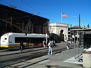
 A #71 trolleybus boarding passengers at the start of an inbound trip | |
| General information | |
| Location | Watertown Square, Watertown, Massachusetts |
| Coordinates | 42.36546°N 71.18564°W |
| Owned by | Massachusetts Bay Transportation Authority |
| Line(s) | |
| Construction | |
| Disabled access | Yes |
Bus service
Watertown Square is a minor transfer point for MBTA bus services. Two routes terminate at a two-lane bus loop that forms the west side of the square; the 71 is one of four trolleybus routes operated from the Harvard bus tunnel and a key bus route.
- 59: Needham Junction–Watertown Square
- 71: Watertown Square–Harvard station
One additional route passes on the north side of the square on US-20; it serves a westbound stop just north of Watertown Square, and an eastbound stop a block to the west.
- 70: Market Place Drive or Waltham Center–Central Square, Cambridge
Watertown Yard, located 300 feet (91 m) to the south across the Watertown Bridge, is also a bus transfer point. Trolleybus wires for the 71 run to Watertown Yard, which at times has been used as a depot for the trolleybuses. From June through December 1984, the 71 and 70 short turns were extended to Watertown Yard during reconstruction at the square.[1]
Railroad station
The Watertown Branch Railroad opened through Watertown Square in 1847. Passenger service on the line ended on July 9, 1938, and the second track was removed by early 1940.[2] The middle section of the line from the Waltham/Watertown line through Watertown Square to East Watertown was abandoned in 1960. The former Watertown station was reused as a lumber company by 1968, but later demolished.[3]
References
- Belcher, Jonathan. "Changes to Transit Service in the MBTA district" (PDF). Boston Street Railway Association.
- Humphrey, Thomas J.; Clark, Norton D. (1986). Boston's Commuter Rail: Second Section. Boston Street Railway Association. p. 52. ISBN 9780938315025.
- O'Connell, Richard W. (August 18, 1968). "Old railroad depots take on new careers". Boston Globe. p. A-1 – via Newspapers.com.
External links
![]() Media related to Watertown Square at Wikimedia Commons
Media related to Watertown Square at Wikimedia Commons
Другой контент может иметь иную лицензию. Перед использованием материалов сайта WikiSort.org внимательно изучите правила лицензирования конкретных элементов наполнения сайта.
WikiSort.org - проект по пересортировке и дополнению контента Википедии