railroad.wikisort.org - Station
Munich Leuchtenbergring is a railway station on the Munich–Salzburg line in the Bogenhausen quarter of Munich, Germany. It is an elevated station above the Leuchtenbergring, part of Munich's Mittlerer Ring road system. The station serves both the Eastern part of Bogenhausen (north of the railway tracks) and the western part of Berg am Laim (south of the tracks). It is served by S-Bahn lines ![]() ,
, ![]() ,
, ![]() ,
, ![]() and
and ![]() .[5]
.[5]
Munich Leuchtenbergring | ||||||||||||||||||||||||||||||
|---|---|---|---|---|---|---|---|---|---|---|---|---|---|---|---|---|---|---|---|---|---|---|---|---|---|---|---|---|---|---|
| Bft | ||||||||||||||||||||||||||||||
 2012 | ||||||||||||||||||||||||||||||
| General information | ||||||||||||||||||||||||||||||
| Location | Leuchtenbergring 81677 Munich-Bogenhausen Bavaria Germany | |||||||||||||||||||||||||||||
| Coordinates | 48°8′3.26″N 11°36′57.57″E | |||||||||||||||||||||||||||||
| Owned by | Deutsche Bahn | |||||||||||||||||||||||||||||
| Operated by |
| |||||||||||||||||||||||||||||
| Line(s) |
| |||||||||||||||||||||||||||||
| Platforms | 2 island platforms | |||||||||||||||||||||||||||||
| Tracks | 4 | |||||||||||||||||||||||||||||
| Train operators | S-Bahn München | |||||||||||||||||||||||||||||
| Connections |
| |||||||||||||||||||||||||||||
| Construction | ||||||||||||||||||||||||||||||
| Parking | no | |||||||||||||||||||||||||||||
| Bicycle facilities | yes | |||||||||||||||||||||||||||||
| Disabled access | no | |||||||||||||||||||||||||||||
| Other information | ||||||||||||||||||||||||||||||
| Station code | 4239 | |||||||||||||||||||||||||||||
| DS100 code | MLEU[2] | |||||||||||||||||||||||||||||
| IBNR | 8004134 | |||||||||||||||||||||||||||||
| Category | 4 [3] | |||||||||||||||||||||||||||||
| Fare zone | ||||||||||||||||||||||||||||||
| Website | www.bahnhof.de | |||||||||||||||||||||||||||||
| History | ||||||||||||||||||||||||||||||
| Opened | 27 May 1972 | |||||||||||||||||||||||||||||
| Services | ||||||||||||||||||||||||||||||
| ||||||||||||||||||||||||||||||
 | ||||||||||||||||||||||||||||||
| Location | ||||||||||||||||||||||||||||||
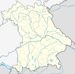 Leuchtenbergring Location in Bavaria 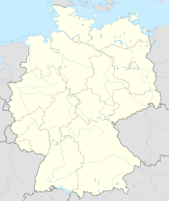 Leuchtenbergring Location in Germany Leuchtenbergring Location in Europe | ||||||||||||||||||||||||||||||
The station is served by bus line ![]() 59.[5] The tram station Ampfingstraße on line
59.[5] The tram station Ampfingstraße on line ![]() is nearby.
is nearby.
Places nearby
- München Ostbahnhof
- Prinzregentenstraße
- Prinzregententheater
References
- "S-Bahn, U-Bahn, Regionalzug, Regionalbus und ExpressBus im MVV" (PDF) (in German). MVV. December 2021. Retrieved 2 March 2022.
- Eisenbahnatlas Deutschland (German railway atlas) (2009/2010 ed.). Schweers + Wall. 2009. ISBN 978-3-89494-139-0.
- "Stationspreisliste 2022" [Station price list 2022] (PDF) (in German). DB Station&Service. 7 February 2022. Retrieved 13 March 2022.
- "S-Bahn, U-Bahn, Regionalzug, Tram und ExpressBus im MVV" (PDF). Münchner Verkehrs- und Tarifverbund. December 2019. Retrieved 28 February 2020.
- "Map of the station area, showing S-Bahn station and bus stops" (PDF) (in German). MVV. Retrieved 22 March 2013.
- "Description and plans of the station" (in German). BEG. Retrieved 22 March 2013.
Munich transport network | |
|---|---|
| |
| |
| Fare Zones | |
| |
| |
This article about a railway station in Bavaria is a stub. You can help Wikipedia by expanding it. |
This Munich S-Bahn-related article is a stub. You can help Wikipedia by expanding it. |
Текст в блоке "Читать" взят с сайта "Википедия" и доступен по лицензии Creative Commons Attribution-ShareAlike; в отдельных случаях могут действовать дополнительные условия.
Другой контент может иметь иную лицензию. Перед использованием материалов сайта WikiSort.org внимательно изучите правила лицензирования конкретных элементов наполнения сайта.
Другой контент может иметь иную лицензию. Перед использованием материалов сайта WikiSort.org внимательно изучите правила лицензирования конкретных элементов наполнения сайта.
2019-2025
WikiSort.org - проект по пересортировке и дополнению контента Википедии
WikiSort.org - проект по пересортировке и дополнению контента Википедии