railroad.wikisort.org - Station
Koh-e-Taftan railway station (Urdu: کوہی تفتان اسٹیشن, Balochi: کوہی تفتان اسٹیشن) (or Kūh-i-Taftān)[1] is in Taftan a dry, elevated, mountainous town in Pakistan. The country's most western station, it is the last station in Pakistan on the Quetta-Taftan Railway Line before crossing into Iran and serves the town notable for the east-west trunk road. It is in the western projection of the far western province, Balochistan.
This article needs additional citations for verification. (November 2016) |
Koh-e-Taftan Station کوہی تفتان اسٹیشن | |||||||||||
|---|---|---|---|---|---|---|---|---|---|---|---|
| General information | |||||||||||
| Coordinates | 28.9726°N 61.5570°E | ||||||||||
| Owned by | Ministry of Railways | ||||||||||
| Line(s) | Quetta-Taftan Railway Line | ||||||||||
| Other information | |||||||||||
| Station code | TFT | ||||||||||
| Services | |||||||||||
| |||||||||||
 | |||||||||||
| Location | |||||||||||
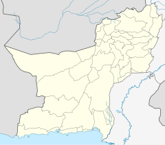 Koh-e-Taftan Station Location within Balochistan, Pakistan 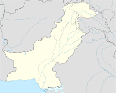 Koh-e-Taftan Station Koh-e-Taftan Station (Pakistan) | |||||||||||
It is 62 kilometres (39 mi) northeast of the thermally active dark peak or small massif also called Taftan, wholly in Iran.
The border, less than 700 metres west, on the line sits at approximately 61.54° east, whereas Pakistan's easternmost station, Chak Amru, in Punjab, lies in an upper valley at about 75.2° east (of the Prime Meridian).
See also
- List of railway stations in Pakistan
- Pakistan Railways
References
- Taftan - last railway station of Pakistan Author: Arshad VLOG

This article about a railroad station in Balochistan, Pakistan is a stub. You can help Wikipedia by expanding it. |
Другой контент может иметь иную лицензию. Перед использованием материалов сайта WikiSort.org внимательно изучите правила лицензирования конкретных элементов наполнения сайта.
WikiSort.org - проект по пересортировке и дополнению контента Википедии