railroad.wikisort.org - Station
Torcy (French pronunciation: [toʁsi]) is a railway station in Torcy, Seine-et-Marne, a suburb east of Paris.
Torcy | |||||||||||
|---|---|---|---|---|---|---|---|---|---|---|---|
| RER station | |||||||||||
 Main entrance at south side (towards the bus station and Bay 2 shopping centre). | |||||||||||
| General information | |||||||||||
| Location | 1 Place de la Gare 77200 Torcy France | ||||||||||
| Coordinates | 48.8394°N 2.6547°E | ||||||||||
| Owned by | RATP Group | ||||||||||
| Operated by | RATP Group | ||||||||||
| Line(s) | RER A | ||||||||||
| Platforms | 2 | ||||||||||
| Tracks | 3 | ||||||||||
| Other information | |||||||||||
| Station code | 87758375 | ||||||||||
| Fare zone | 5 | ||||||||||
| History | |||||||||||
| Opened | 19 December 1980 | ||||||||||
| Passengers | |||||||||||
| 2019 | 4,223,220 | ||||||||||
| Services | |||||||||||
| |||||||||||
History
Torcy opened on 19 December 1980 as part of an extension of the A4 branch from its previous eastern terminal of Noisy-le-Grand–Mont d'Est. It served as the eastern terminus of the A4 branch for twelve years until 1 April 1992, when the RER A4 was extended to Marne-la-Vallée–Chessy; since then, the A4 branch has yet to be extended.
Traffic
As of 2019[update], the estimated annual attendance by the RATP Group was 4,223,220 passengers.[1]
Service
Torcy is on the A4 branch of the RER A and receives frequent service. As of 4 February 2008, during peak hours there are between twelve and eighteen trains per hour (intervals of five and three minutes and twenty seconds), during mid-day trains arrive every ten minutes, and early mornings and late nights trains come at fifteen-minute intervals.[2][3]
The station acts as a terminus for certain trains. Trains that terminate at Torcy will display a headline beginning with O, O being the designation that a train terminates at Torcy rather than Q for Marne-la-Vallée–Chessy.[3]
Bus connections
The station is served by several buses:
 RATP Bus network lines: 211, 220, 321 and 421 ;[4][5]
- Pep's Bus network lines: 13, 21, 25, 29 and 46 ;[4][5]
- Seine-et-Marne Express Bus network lines: 18 and 19 ;[4][5]
- Stigo Bus network line: 18 ;[4][5]
- Transdev Lys (by Setra) Bus network line: 100 ;[4][5]
 Noctilien network night bus lines: N34 and N130.[5][6]
Gallery
 North side entrance
(towards Bay 1 shopping centre) Sign indicating the name of the station
(with overlooking the neighbourhood) A train (MI2N) arriving at the station
(towards Paris) General view to the west (towards Paris)
from the east side of the station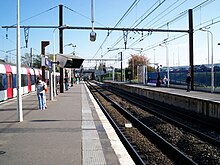 General view of the platforms to the east
(towards Marne-la-Vallée–Chessy)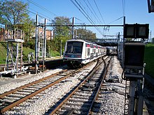 General view to the east (with a MI2N train
that has just left the station)


References
- "Trafic annuel entrant par station du réseau ferré 2019". Open Data RATP (Data.Ratp.fr) (in French). RATP Group. Retrieved 8 August 2021.
- RER A timetable towards Cergy-le-Haut RATP Retrieved 24 December 2008
- RER A timetable towards Marne-la-Vallée–Chessy RATP Retrieved 24 December 2008
- "Plan du réseau de bus à Marne-la-Vallée (Secteur n°11)" [Map of the RATP bus network in Marne-la-Vallée (Sector n° 11).] (PDF). Ratp.fr (Color map showing the names of bus stops and main streets.) (in French). RATP Group. May 2020. Retrieved 19 August 2020.
- "Plan du réseau de bus à Marne-la-Vallée (Secteur n°45)" [Map of the bus networks in Marne-la-Vallée (Sector n° 45).] (PDF). Transdev-idf.com (Color map showing the names of bus stops and main streets.) (in French). Île-de-France Mobilités. January 2020. Retrieved 23 August 2020.
- "Plan du réseau Noctilien (2017) - (Secteur : Paris & Sud-Est)" [Map of the night bus (Noctilien) network (2017) - (Sector: Paris and its south-eastern suburbs).] (PDF). Ratp.fr (Color map showing the names of the bus stops and the cities served.) (in French). RATP Group. April 2017. Retrieved 19 August 2020.
Другой контент может иметь иную лицензию. Перед использованием материалов сайта WikiSort.org внимательно изучите правила лицензирования конкретных элементов наполнения сайта.
WikiSort.org - проект по пересортировке и дополнению контента Википедии