railroad.wikisort.org - Station
Rotenboden is a railway station on the Gornergrat railway, a rack railway which links the resort of Zermatt with the summit of the Gornergrat. The station is situated west of the Gornergrat, in the Swiss municipality of Zermatt and canton of Valais. At an altitude of 2,815 m (9,236 ft) above mean sea level, it is the second highest open-air railway station in Europe, after the Gornergrat railway station, on the same line.[1][2][3]
Rotenboden | |||||||||||
|---|---|---|---|---|---|---|---|---|---|---|---|
 | |||||||||||
| General information | |||||||||||
| Location | Zermatt, Valais Switzerland | ||||||||||
| Coordinates | 45°59′04″N 07°45′55″E | ||||||||||
| Elevation | 2,815 m (9,236 ft) | ||||||||||
| Line(s) | Gornergrat railway | ||||||||||
| History | |||||||||||
| Opened | 20 August 1898 | ||||||||||
| Services | |||||||||||
| |||||||||||
| Location | |||||||||||
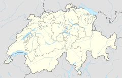 Rotenboden Location within Switzerland | |||||||||||
From the railway station a trail leads to the Monte Rosa Hut, across the Gorner Glacier.[4]
See also
- List of highest railway stations in Switzerland
References
- "Fahrplan Zermatt - Gornergrat (28.04.2014 - 06.06.2014)" [Timetable Zermatt - Gornergrat (28.04.2014 - 06.06.2014)] (in German). Gornergratbahn. Archived from the original on 2014-06-05. Retrieved 2014-05-30.
- "Betriebsdaten" [Operating data] (in German). Gornergratbahn. Archived from the original on 2014-06-02. Retrieved 2014-05-30.
- map.geo.admin.ch (Map). Swiss Confederation. Retrieved 2014-06-01.
- "The Walking Guide - Rotenboden to the Monte Rosa Hut". ski-zermatt.com. Retrieved 2014-06-01.
External links
 Media related to Rotenboden railway station at Wikimedia Commons
This article about a railway station in Switzerland is a stub. You can help Wikipedia by expanding it. |
Текст в блоке "Читать" взят с сайта "Википедия" и доступен по лицензии Creative Commons Attribution-ShareAlike; в отдельных случаях могут действовать дополнительные условия.
Другой контент может иметь иную лицензию. Перед использованием материалов сайта WikiSort.org внимательно изучите правила лицензирования конкретных элементов наполнения сайта.
Другой контент может иметь иную лицензию. Перед использованием материалов сайта WikiSort.org внимательно изучите правила лицензирования конкретных элементов наполнения сайта.
2019-2026
WikiSort.org - проект по пересортировке и дополнению контента Википедии
WikiSort.org - проект по пересортировке и дополнению контента Википедии